Wedding Song - God Knew That I Needed You

Wednesday, August 5, 2020

DAYTRIP w-TRUDY & ED ~ Mt. St. Helen’s


Yesterday, Trudy texted me and asked if I’d like to get out of the house and go with them to Coldwater Lake, and stop at Seaquest State Park on the way home … I said. “Yes! I’d like to go.”


I’m all for getting out of the house every chance I get 😉

I didn’t dress fancy; I was going to be outside with wind blowing, so there was no point to dolling myself up to play tourist. I just washed and dried my hair, pulled a pair of jeans on, yanked a polo shirt on, and tied my hiking shoes … I am not a delicate flower – I really do pull and yank 🤣😂

So, they picked me up around 9 AM this morning, and we were off.


We each brought a lunch of sandwiches; and Trudy brought 3 homemade Whoopie Pies – SO YUMMY! I slipped my sandwich and cola into their cooler and buckled in.


We started off the day with a drive up to the Johnston Ridge Observatory.

The weather was favorable, and stayed nice all day – even at the higher elevation. The Observatory sits on a bluff 4,314 high in elevation, and 5½ miles from the steaming dome bulging out of the cavernous volcanic crater left after Mt. St. Helen blew her top in 1980:

Johnston Ridge Observatory from Heron Pointe. 1 hr.25 mins
Wildflowers; Dandelion, Lupine, Daisies, and Indian Paintbrush greeted us along the paved path to the Johnston Ridge Observatory viewing platform.
Trudy & Ed.
Me, Trudy & Ed.
The crater dome ... steaming.

Bob & I spent a lot of time fooling around the foothills of Mt. St. Helens; either on the Harley, or in the ’56 Ford – I liked the mountain, Bob liked the Lake ... and at the time they were joined at the hip. Our daughter, Stacey, had her 1st ‘out-of-house diaper change’ on the flanks of Mt. St. Helens when she was just a week old.

People get excited about the smoking crater, when they look at Mt. St. Helen, now: I remember what was; I remember how saintly beautiful Helen was before she threw her explosive temper tantrum that destroyed forests for miles around, and literally lifted Spirit Lake from where it lay at her feet … and catapulted it miles away with a massive wave, to drop it in a new locale 200 feet above where it used to lay so serenely.

When I look at the volcano, I do not see powerful beauty – I see powerful destruction. When I watch steam rise from the bulging dome, I see a temper barely held in check. I can’t look at the ugly gaping maw for too long: I want to remember the majestic beauty that is gone forever in my lifetime.

So, I focus on the regenerating life that is slowly settling upon the ravaged land again - beauty out of death. Life up there is slowly regenerating, and it is exciting to see; and experience …

What Mt. St. Helens & Spirit Lake looked like before the May 18th, 1980 eruption: it was a beautiful setting.
Spirit Lake transplanted.
The violent eruption drastically altered the lake’s locale, depth, and sustainability. The lake now, is shallower; and toxic.
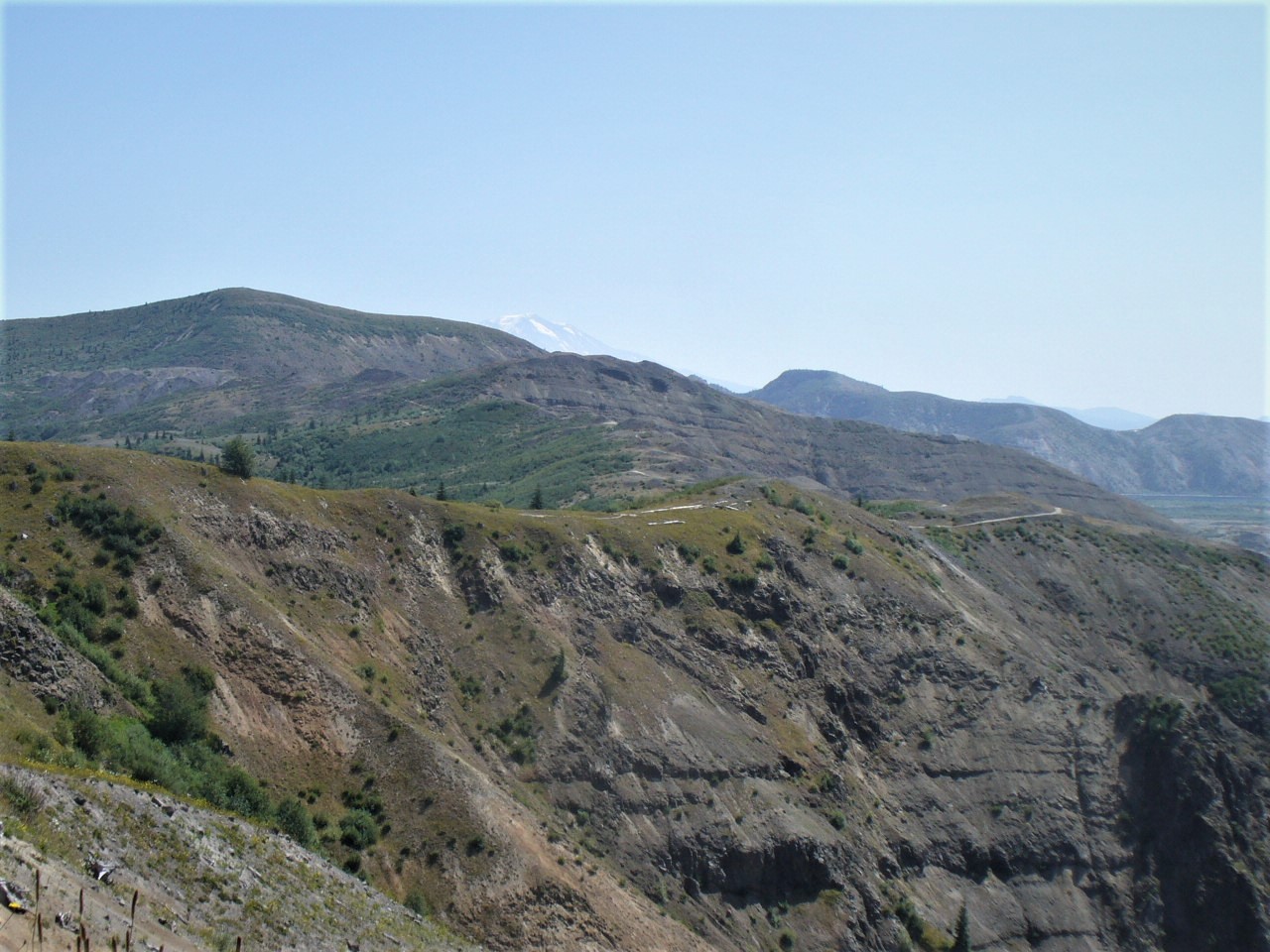
Mt. Rainer peeking over the peaks, through the haze ...
Topless Mt. St. Helens. When you see the massive size of the headless volcano, you feel so small. You feel humbled.
Trail
Large basalt boulders; rocks interest me. These look so small in the distance, but I am sure that ‘up-close-and-personal’, they are GIGANTIC behemoths.
Me; I’m standing several feet above the Observatory – and the Observatory is 4,314 feet above ground zero. But my asthmatic lungs aren’t feeling any distress at all.
Johnston Ridge Observatory seen from where I stood on the trail - it looks like a WWII bunker. MPO.

We walked the monument loop, from the observatory back to the parking lot. People we met along the way were friendly and talkative.

Pretty, and colorful little trumpet-petaled wildflowers hugged the paved footpath. Tiny, annoying, swarming bees unmercifully pestered us when we walked too close to their sweet-tree (I was carrying protection in case of a sting); and a chipmunk amused us with it’s hamming for attention:

Lilac hued trumpet flowers.
Pretty little trumpet wildflowers - kinda pinkish with blue edging.

Little Ham 'Munk; he teased and teased ... but I finally 'got' him ðŸ˜‰
Photo-op chipmunk. He knew just what to do … and how to pose for maximum effect. LOL

We left Johnson Ridge Observatory, and drove to Coldwater Lake, where we ate our lunches – the cherry tomatoes Trudy and Ed shared with me were tartly delicious: they tasted like full-bodied tomatoes, not those hothouse tomatoes sold in grocery stores. And we were all commenting on how stuffed we were after finishing off our woopie pies 😉

Then we took a leisurely stroll along the paved footpath, and planked boardwalk.

Last time I was there was with Bob and Precious (my wolf: ½ Timber Wolf/½ Gray Wolf).

Precious has been happily romping the Happy Hunting Grounds for 6 years – that’s how long its been since I was there. We used to drive out there once in a while to enjoy the quiet, and let Precious run free when we were the only ones there.

Bob is walking beside her beyond the clouds now too; Bob has been gone from my life for 19 months/22 days/18 hours-9 mins.

I am glad they are enjoying each other’s company again, but I miss them both down here …

Bob and Precious, 2 houses ago; Bob playing one of his online games ... and Precious wanting to play games. Merritt Drive – 2006

Coldwater Lake was created 40 years ago during the Mt. St. Helens 1980 eruption; it was created by the huge landslide of debris that wildly raced down the North Fork Toutle River and birthed this lake into being. It is a popular place for summertime recreations – today, we 3 were picnicing:

Coldwater Lake from Johnston Ridge Observatory - 8 mins
Coldwater Lake Information Plaque. We ate lunch here.
Kayaker in Coldwater Lake. This lake was created with the eruption of Mt. St. Helens. Both parking lots were packed; this was a very busy place Tuesday afternoon.
Mt. St. Helen's Science & Learning Center - closed to the public, open for space rentals.
A Hummock.
The lake was busy with kayaker’s and swimmers.
Hikers on the trail ...
Coldwater Lake.
Jagged basalt spires. It was very hazy today.
ME. A cloud cover had moved in over Mt. St. helens in the distance ...
Seaquest State Park from Coldwater Lake - 48 mins.
Heron Pointe from Seaquest State Park - 30 mins

We stopped at Seaquest State Park on the way home. It was a fun day today; and an enjoyable daytrip drive.


Tuesday, August 4, 2020

SUNDAY~FUNDAY #16: I’VE EARNED MY WINGS - Packwood & Randle


Sunday, I woke up wanting Cowboy Coffee.

The coffee was in Packwood: an hour away 😉

So, I jumped out of bed, and got dressed. I packed a small cooler with an ice pack, water to cool the scalding coffee (so I could drink it before I got back home), and half an Italian Sub sandwich since Sunday was National Sandwich Day 😉 Before I left town, I stopped at Baker’s Corner to grab a Vanilla Coke & 6 pieces of fried bacon to get me through the morning: 9 AM was just too early to eat; snacking is about all I can do until around noon – the coke would wake me up, the bacon was ‘make my tummy happy’ food.

My wakeup thought … Packwood - I'm not ready to push past Packwood to Mt. Rainier. Yet - someday though.
There is no point to the mask wearing - this mask will spread covid through the air vent. ALL the employees were wearing them. People are going through the motions, but the motions are worthless.

As I passed through Toledo, there was road work going on – so, I was pointed to Detour Arrows. And I laughed as I drove, thinking, “See Babe … I can do new things without freaking out. And I’m not getting lost this time because there are signs pointing the way”.

MAP Toledo from Heron Pointe; about 50 mins on backroads w-detour.
Packwood from Toledo; via Jackson Highway backroad access. 1 hr-15 mins.
I liked the fancy design on the silo – the barn was pretty fancy too; the farmer had money to play with: brick was a very expensive way to build back then. Jackson Highway. 
Topless ‘Helen seen from Jackson Highway.
Hay baled in a detour field - the old fashioned way that looks a lot better than those stupid white plastic sheathed round bales.

The drive was uneventful, scenic, and relaxing.

Just the way I like it … and the reason I avoid the freeway :-D

I will come back this way next month to grab some Tulip bulbs to plant for Spring color.
Mt. Rainier peeking up over the hilltops coming into Morton.

In Glenoma, I passed the RV Park where Bob lived in our 35-foot Taurus travel trailer for a few years while logging the surrounding hills – most of his work crew lived there too; there was also a store and a golf course. Bob liked to golf after work, and he was a very good golfer – when he golfed tournaments at home, he always brought home trophies and I bought a wall rack to show them off :-D When Bob lived away from home for work, he left home every Sunday around noon, and came home every Friday night – he called home every Wednesday to talk for hours; catching up on what was happening at home with the kids, and just to hear my voice. Those phone calls were lifelines for the both of us during those years.


It was in Glenoma, where Bob got pneumonia so bad I thought he would die – he sounded horrible on the phone that Wednesday he called and I said I’d feel better if he didn’t try to make it home that weekend – he didn’t, but he did come home the following weekend, before Christmas eve, and the kids and I were both scared when he walked through the door: he looked like he would kill right over – he could barely stand up and he looked like death walking; he had lost so much weight during the fever that he was rail thin, hallow cheeked, and had dark rings around his eyes. He looked bad. Real bad. I got him to his recliner and the kids sat at his feet, crying, and begging me to let them give him the gifts they had made for him “because he might die!”  I didn’t even try to usher them to bed – they wouldn’t have gone without a fight: they were as scared as I was. We all slept in the livingroom that night – the kids like little pups at his feet, and me curled around him in the recliner: the woodstove burned all night long. As soon as Dr. Avalon’s Office was opened Monday morning, I took Bob to see what could be done to counter the pneumonia – diagnosis was rest and tender loving care; he’d already gone through the worst of it in Glenoma.

When Bob went back to work a week later, in January, I knuckled down, studied the Driver’s License booklet, and got my Driver’s License in the Spring – I wanted to be able to get to Bob if he ever got that sick again … and I never wanted him to feel the need to drive that sick again, to get home and see that his family was okay.

For years I hadn’t felt the need for a driver’s license – everything we needed was 3 minutes away from our front door in Cathlamet: post office, grocery stores, pharmacy, doctor, dentist, lawyers, schools, hardware stores, hotels, motels, laundromat, nickel-n-dime stores, gas station, churches, library; everything was minutes away. It only took 7 minutes to walk from our house to the High School on the hill (6 minutes to the Elementary school where our daughter went: Stacey was 9, Sara was 4). There was no need to drive. But when Bob got so desperately sick … suddenly, there was a real need.

It was also in Glenoma, where Bob lost his Wedding Ring: he had lost so much weight with that bout of pneumonia, it fell off his finger on the landing and got trampled into the muck before he noticed it was even gone: he was so dizzy and just trying to stay alert enough to get his job done. He didn’t even notice it was gone until he got to the trailer and started washing the day’s grease and grime off his hands. He said he was sick with the realization, but he knew he would never find it on the landing – it was hopelessly gone.

And every time we passed that mountain he worked that year, we’d look at each other and say, like tarheels, “There’s gold in them thar hills” – and we’d laugh.

I laughed Sunday too, when I passed it, but Bob was not there to get silly with. It was a hollow moment. So, I shook the memory and continued forward on the drive.

But Memory was not finished with me yet – it poked me hard at the rest area just a bit up the road. The last time I was there was with Bob and our 4 year old grandson, having a little picnic before heading to Lake Tipso.

I hope the crying jags lessen ...

When I finally reached Packwood, I found that Cowboy Coffee had been sold! The large steel Cowboy silhouette was no longer lounging against the wind, and it was under new management – and the coffee itinerary is cutsie stuff, nothing I recognize; or want <:-O But, the girl said she could make me a French Vanilla: and the coffee was fine – a little strong, but good; and drinkable! I never liked getting coffee so hot I couldn’t even sip it until I was back home in the carport … that’s why I always bring chilled water to cool it off with: but I didn’t have to do that this time; she made it drinkable – I like that :-D

A lot can happen in 24 months …
Bob sitting a horse; so tall, he made the horse look small – he always looked good, no matter what he was doing. I miss those hands …
BOB. 1967
Mt. Rainier seen from the parking lot, kitty corner from Base Camp Coffee.

Heading back home, passing through Randle, I noticed a road sign off to the left that said, Mt. St. Helens, and I thought, “Why not? I don’t mind getting home via Toutle …” So, I sipped my coffee and turned down the road and towards a solo lobo adventure 😉

Spur of the moment decision passing through Randle ...
On my way with little clues and lots of chutzpah.
The road is awful.
I had flagged people down (just stuck my hand out the window until they stopped) and asked specifically if this road went all the way through to Toutle … I was told that it did.
In my ignorance, I was thinking how 'fun' this was ...
The road got progressively worse.

After what seemed like an eternity of seriously rough road, hair-raising drop-offs at road edge, and warning of falling rock along the cliff-side of the roadway – a scenic turnout appeared; I quickly turned in. There was an actual restroom here; not just a stinking porta-potty. There is also a fee station, and a Pass requirement. I saw some pretty light blue trumpet flowers, that at first glance, looked like a ground hugging foxglove: but it wasn’t – and I can’t find anything like it in online searches.

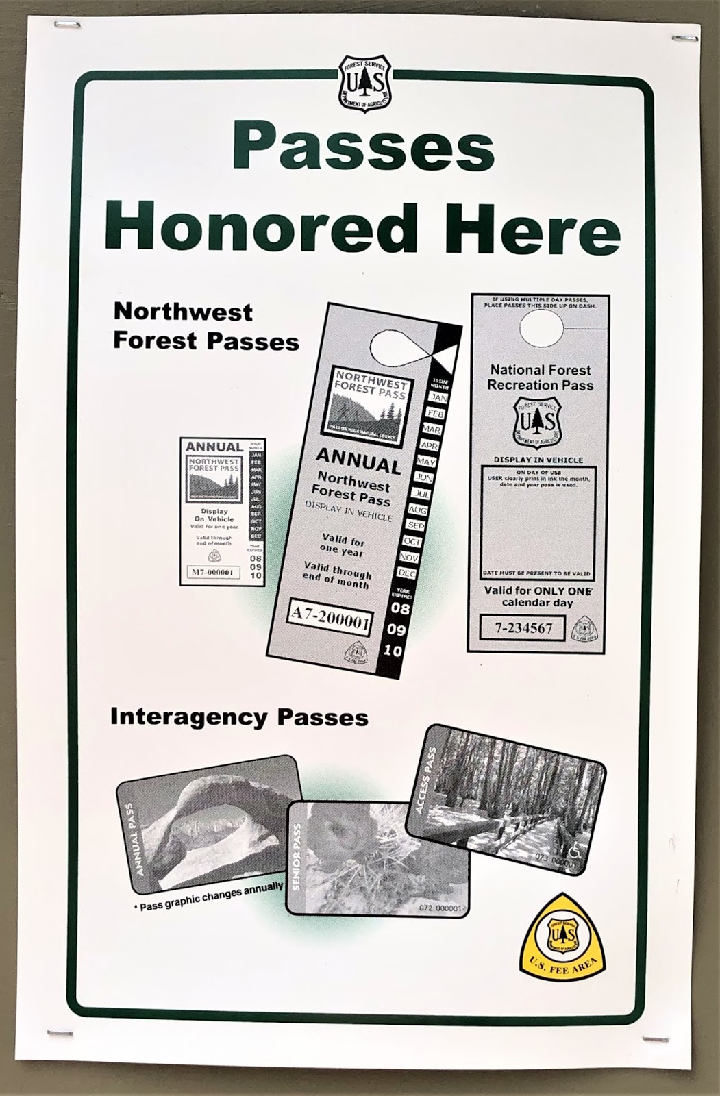
Forest Passes are unavailable because ranger Stations are closed due to covid. Bob's Senior pass is acceptable – and I can use that.
Pretty little trumpet type flowers. Bear Meadow.
Mt. Rainier & Mt. St. Helens Viewpoint. I was speaking on what I was told …
Location.
Topless Mt. St. Helen’s; zoomed in.

The road getting to this point was like maneuvering a minefield.

Reality bit at Meta Lake.

There were other people there too, so I asked a family that looked like they came from logger’s stock (grandpa was wearing all the clothing, though he was no longer active) if the road I was on would take me to Toutle – around Mt. St. Helen’s: grandpa said “No – it only goes to Windy Ridge, then you have to backtrack to Road 99 to Cougar.”

I was not happy to hear that: getting to this point was a hell ride – remembering what the opposite lane looked like on my way here was scary. The side I came up on was atrocious … going back, on the opposite side of the roadway was not something I wanted to think about; or do!

The Highlander is an all-terrain-vehicle, but I still don’t know HOW to turn it into a 4-wheeling machine; I know it has the capabilities, but I’ve never used that before. If ever there was a road for the 4-wheel function … I was on it!

Without a clue.

Meta Lake: game changer.
Meta Lake Road Map
Meta Lake was more like a pond than an actual lake.
Not looking forward to the backtracking – it had taken 1½ hours 1-way to reach Meta Lake.
Back at Scorched Zone Viewpoint. I am earning my wings at this point ...
It was a hell ride back to Randle on those minefields called roads - I employed every driving skill Bob ever exampled to get from A to Z safely ...
Patches of roadway totally peeled away to gravel … rolling off the 1,000-ft. edge to the yawning gorge below; gaping potholes large and deep enough to swallow my hefty SUV; zig-zagging fissures spiderwebbing sunken spots where the road had slid out from under the blacktop: the adrenaline was pumping – but not in a good way.

All the way back to civilization, I nipped into every available turnout (there were only 3: 2 viewpoints & a very skimpy car width pullover spot) – to park the car, breathe deeply, and relax so I could go at it again. There was 1 short guardrail the entire length of the road. I earned every gray hair I scared the color out of Sunday: this will not be a repeat drive.

But I managed to laugh through it all & say, “Babe, if you are watching this unfold, you better be proud of me”; laughter is my pressure relief valve. Talking to Bob’s spirit is my comfort in tight spots.

My hands were a soaking wet, aching reminder that I had not died of a heart attack 😉

One thing I kept telling myself was, ‘If I can get through this road’s hurdles, I KNOW I CAN drive the Mount Rainier Loop! That thought fortified me: I’ve been missing my beloved Box Canyon.


When I reached the junction of decision, I opted to go back home through Randle. I don’t like freeway driving at all (which I would have had to drive from Cougar), and it would not have been wise – under any circumstance – to do freeway driving after the hell ride out of the Gifford Pinchot National Park.

So, I turned left.

I went back to Randle; closer than Cougar, and I never have to touch the freeway via Randle.

And was glad I did, because a little further up the road, I got a treat :-D

The Iron Creek Falls was a treat for the eyes; it was a little tricky getting to view them, but worth it.

Bob and I always stopped at falls … Bob loved water in general, but the sound of falls was very soothing – even wild and loud ones ðŸ˜‰
I love the sound of vitality a forest gives off.
1st tier of stairs leading to the Falls. The shale is very loose. I was glad I had my walking stick. Thank you, Babe (!) for pointing it out to me at that Bazaar we did :-D
Root laden path into the forest.
2nd tier of stairs leading to the Falls – this is the biggest challenge concerning the loose shale: even with the stairs, the shale is very dangerous – it is easy for your feet to go out from under you here.
Iron Creek Falls.
Iron Creek – I did eventually make it to the creek ðŸ˜‰
I got a cardio workout getting back to the car.
Despite the asthmatic huffing and puffing, I did not need the inhaler ...
I think I may have to have the Highlander's undercarriage checked out; the underside bottomed out on deep potholes twice. It's coming time for a checkup again, so I'll do it then.

Leaving Randle, I saw the hanging cliff – and, just up the road a couple paces, I saw the little burger bar we used to stop at once in awhile… so, I nipped in and bought a cheeseburger for old time’s sake – the sandwich in the cooler could be eaten later 😉

Hanging cliff in Randle; I have seen mountain goats walking on that thing.
Umm, umm: GOOD.

When I finally got home, the sunset was colorful – a nice ending to an 11-hour adventurous day.


The day was exciting.

It was scary.

It was encouraging.

I feel revived.

I feel bold.

I feel accomplished.